
Walking in Portugal: GR50 from Tourém to Xertelo
In my Summer Update I talked about the plan to fly to Portugal and walk the GR50 through Peneda Gerês National Park. It required some careful planning to understand the Covid restrictions, tests to enter Portugal and test to enter the UK again, but also what the route looks like, which was by far the most interesting!
The original plan was:
- Fly Stansted to Porto
- Train from Porto to Braga
Bus from Braga to Montelegre (https://www.transdev.pt/cic/2)–>Taxi from Braga to Tourém @60eWalk Montelegre to Tourém- Walk the GR50 or other mountain paths to Gerês (the GR50 route is about 85km for this stretch)
- Walk further if there is time and then circle back to Gerês.
- Bus from Gerês to Braga (http://www.hoteisgeres.com/transports.html)
- Train from Braga back to Porto
- Fly Porto to Stansted
The drive from Cornwall to Stansted Airport was a nightmare, with torrential rain most of the way, slow driving and arriving late to the hotel. However, the flight and arrival in Portugal went flawlessly and we hopped straight onto a train to Braga. We had booked Basic Braga hotel, so it was a short walk from the platform to the hotel right next to the station. The first thing I spotted was a succulent growing by the front door, and I made a note to return the same way for some casual leaf plucking. One of my April 2021 lockdown hobbies is a succulent addiction collection.

We toured the shops around the city via taxi looking for a map and screw top camping gas. The camping gas we found at the local Decathlon outside of town but the map was nowhere to be found. In England it is easy to find an OS map of anywhere in the country but Portugal is not as well mapped. We gave up on the idea of finding a map and instead I found a KML file on the Walking Peneda Gerês website which could be loaded into the Maps.me app and showed the exact route on my phone. I prefer to have a paper map but the excellent signing on the route and maps on the app did the trick. The rest of the day was spent looking around Braga and then eating at a local restaurant. I even discovered ornamental Cabbages growing around a fountain in Campo das Hortas!


In the morning we made our way over to the central bus station and started trying to figure out which bus went where, and which went somewhere nearby but not where we wanted to be. The station had ten or so different bus companies operating and so trying to find the right one quickly got confusing. We sat down to look at timetables and I gazed around the station. At one end was a cleaner woman with an oversized floor mop making her way up and down, she gradually got closer and closer and we moved out of the way, but she kept sweeping and started swiping at my feet for a couple of minutes with the huge broom mop. Slightly odd behavior…
We gave up on the bus system and instead found a taxi through the Portuguese Free Now taxi app. A driver quickly turned up and started driving us out of the city, then he pulled over and asked us to confirm the address. We pointed to Tourém and he looked at us like we were crazy, so we reiterated Tourém and he shrugged and started driving. It cost 60 euros (30e each) and took about two hours, arriving at around midday. Money well spent to get us to the start of the GR50!

Having spent a few days in the country, the surprising thing for me was that whilst it had all the characteristics of a hot country, it was also very alive, both green and vast swathes of yellow covering the hillside. The walk on the first day took us mostly along well-established mountain tracks and past grazing cattle along the Portugal-Spain border. Once in the mountains I could identify the yellow flower as Broom, most likely named as the long stems can be cut and tied together to make… a broom.


After a couple of hours of walking we spotted Casa Abrigo, a mountain refuge sitting on one of the peaks. It was still early but we decided to live luxuriously and camp at 14.30, enabling me to spend some time insect hunting and taking photos!

We pitched the tent on the grassy side with a view and cooked on the leeward side as the temperature dropped in sync with the setting sun. We later realised that Casa Abrigo is the one of the highest points along the GR50 route.


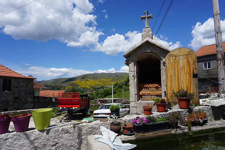
The next day we passed through Pitões das Junias, a peaceful village nestled on the side of the valley. The thing that stood out to me was the sheer quantity of Granite used in construction. One house had Granite steps, Granite slab/brick walls, Granite railings, the only thing not Granite was the tile roof. I grew up near Dartmoor which has plenty of Granite, but despite this it is not used much for construction.

Just down from the village is Cascata Pitoes das Junias, the first waterfall on our route. It’s viewed from a solid feeling wooden series of steps and platforms descending down the hillside opposite the waterfall.


Once again in the countryside, we walked through hills golden with Broom. Despite seeing signs for something called ‘Fojo Do Lobo’, it wasn’t until Xertelo that we put two and two together and realised what it was.

The beauty of Outeiro struck me when I first walked up and into the village. We came through the water meadows and up into the village to see our first Espigueiros/Canastros, a Granite granary used to safely store grain and corn from the damp and rats.

We stopped at the village fountain to have a drink and watched a goatherder direct a large herd along the highstreet.

We dropped down to Paradela Reservoir in the hope of finding somewhere to wild camp. But found it a struggle as the reservoir had mostly steep sides with sharp rock or spiky plants. We carried on looking and eventually found a spot by one of the smaller dams at 5pm, fortunately it had been cleared of undergrowth by a recent wildfire and there was a small spot for the tent.

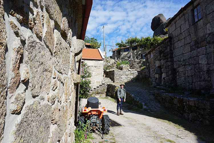
The next point of interest was Sirvozelo, a small village sandwiched between two huge Granite monoliths. The houses are designed around the boulders and many are used as walls and supporting structures in the buildings.

Between Sirvozelo and the next small village of Cela is a hidden waterfall that is not notable enough to be marked on the maps. The footpath descends down a steep hill into a narrow gorge where it crosses the river, just below the crossing point is a small waterfall tumbling into a deep pool. It’s ideal for swimming other than the narrow sides preventing any warmth from reaching it.

We continued through the water meadows, and whilst looking for a lunch spot discovered that ‘water meadow’ literally means a meadow with water running through it. The grass is a lush green but underneath is a steady river of water.
The next waterfall, Cascata Cela Cavalos, just beyond Cela is a lot better for sunbathing and taking a dip, though is also a lot more popular and accessible.


At Xertelo we saw another sign signposted ‘Fojo do Lobo’ and this time followed it to find our first wolf trap. Wolves hunted the local flocks and were in turn hunted over the centuries. The northern part of the Iberian Peninsula is scattered with these wolf traps, where the locals would drive the wolf into the funnel and down into the trap at the point.
Fortunately, the Iberian Wolf is now a protected species and you may be lucky to see a pack roaming the mountains.

At Xertelo we spotted a sign for the PR9 and decided to follow it into one of mountain valleys for a change of scenery. I spotted something called ‘Sete Lagoas’ on the map in the same general direction and decided it sounded interesting enough to visit, without knowing what exactly it is, other than lagoas sounds like lagoon.
So we left the GR50 at around midday and started following the new route up into a steep gorge.
The route and blog posts

1. Walking GR50 in Portugal: from Tourém to Xertelo
2. PR9: Finding Trilho Sete Lagoas
3. Walking GR50 in Portugal: Xertelo to Geres
4. GR34: Serra Amarela trail

