
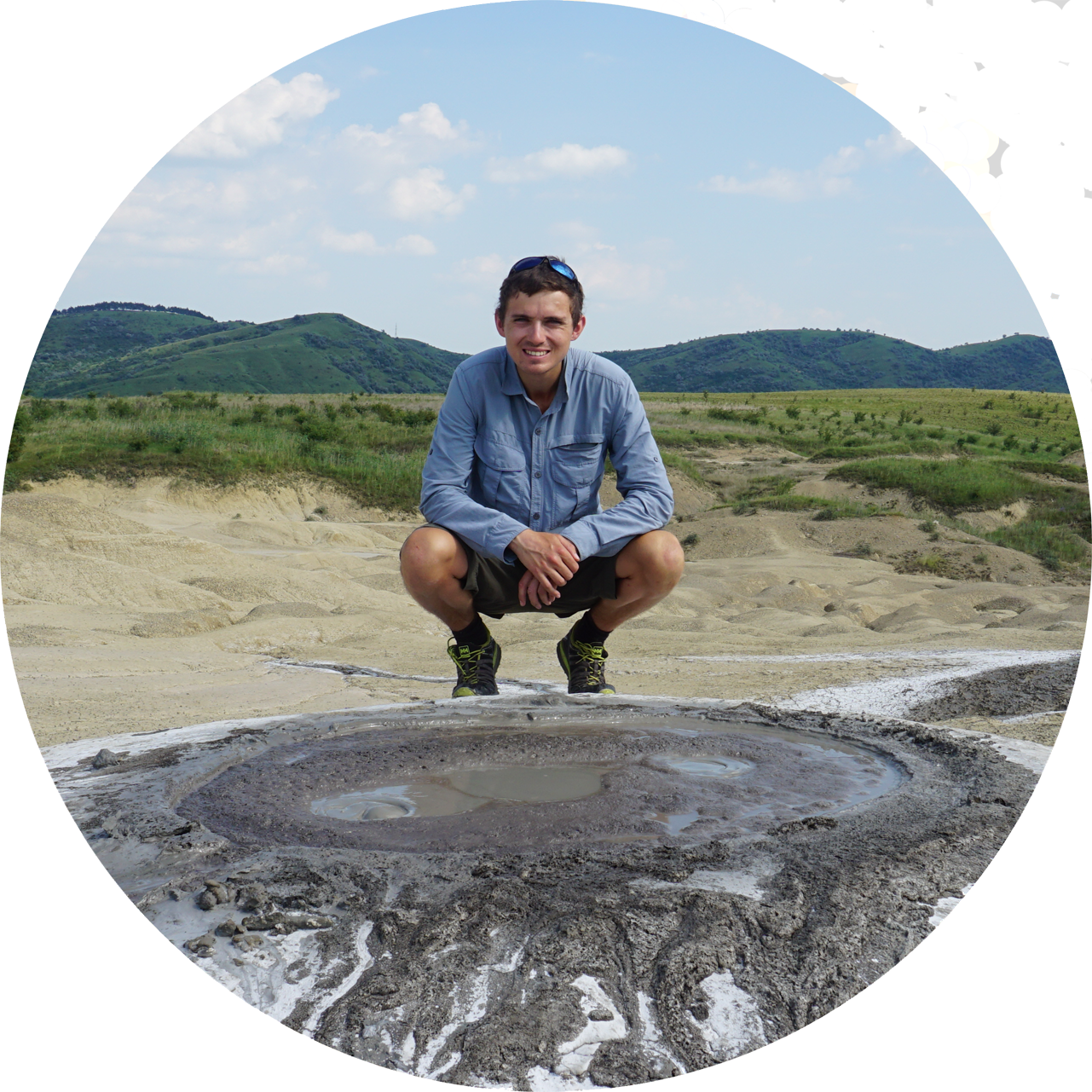
Wild Camping on the West Highland Way
I completed walking the West Highland Way in Scotland, from 29th April to 7th May 2023. I had planned to use the double bank holiday for a walking trip for some time and eventually settled on Scotland, as it is before midge season and the route is about the right length for roughly 9 days of walking. I was not the only one, and many of the people I spoke to were also there to take advantage of the bank holidays, and also because the weather forecast was promising for the week.
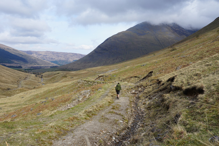
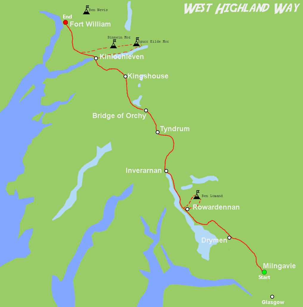
The route is 96 miles, from Milngavie outside Glasgow to Fort William. Most people say to plan a minimum of five days (roughly 20 miles a day), and longer itineraries are around 7 days (13 miles a day). I decided to give myself even longer, but also go off route to find good camping spots and bag a few Munros as well.
The map below shows the West Highland Way and the main places I went off route to use up some time. I camped on the side of Ben Lomand and then spent a morning walking up to the top to admire the interior of a cloud, and a night camping on Loch Eilde Mor and climbing Sgurr Eilde Mor and Binnein Mor the following day, also to ponder on why clouds are white on the inside.
I have walked up Ben Nevis before and had no interest in doing it again, especially on a bank holiday. Towards the end of the WHH I looked at the path through binoculars and there was a steady stream of people going up to take selfies in a cloud.
On the first day I passed a sign illustrating the route and key heights involved. It shows how the route starts off quite flat around Loch Lomand but then starts to climb towards Fort William. Most guides recommend starting at Milngavie to get used to walking ahead of the steeper sections on the second half, but it’s not like the Pyrenees or Alps and could be done either way.

I left the house at 5am and caught a train to Birmingham airport. It was very busy even at that time in the morning because of the bank holiday. I landed at Glasgow airport at 9.40 then caught a bus to the city centre. My first goal was to look for camping gas to keep me going for the next 9 days. The first shop I tried had sold out, the second only had clip top gas, and the third was also sold out. After zigzagging over Glasgow I found a fourth camping shop which had a 500g screw top gas in stock, phew! I made my way back to the station and caught a train to Milngavie to start the walk.
The start of the walk is quite the feature, with lots of advertising and signs. It was a grey start but fortunately no rain. The forecast for Sunday looks very wet but it should then improve during the week.

I found that there were lots of people walking the WHW though hope it will decrease after the bank holiday. Most people also walk in the same direction so feasibly I may never see a lot of them until I stop. On the first night I wild camped just before Gartness next to a river flowing out of a wooded valley.
It was mostly dry when I woke up but the tent was wet from rain overnight so had to pack it away wet. The walk to Lock Lomand was mostly flat through drizzle until 1pm. Conic Hill was very busy with a bunch of French children throwing themselves down the side.
I had planned to camp at 3pm beside the loch but started seeing ‘Camping Management Zone’ signs along the footpath and realised that back in March 2017 they had introduced a camping permit system across the National Park where certain areas require buying a permit online before pitching your tent. This scuppered my plan to have a shorter day, the options were to:
A. Buy a permit.
B. Walk the majority of the loch, about 8 miles to the end of the zone and then however much further until I saw somewhere to camp.
C. Find somewhere outside the permit zone.
The decision was made easier when I saw that the camping zones were already full of people camping and more were still walking. I looked at the map saw that the zone only includes the edges of the loch and so I decided to climb into the mountains to escape.
I had a late lunch beside the loch and the rain lifted at 1pm though I could see the mountain tops were still covered in low cloud.


I left the loch after lunch and walked for about an hour, following a path to the top of Ben Lomond, a Munro at 974m. I spent 20 minutes exploring the hillside for water and eventually found a small stream with a flat-ish spot that wasn’t too boggy.
I was overjoyed to find it still clear in the morning with the loch fully visible. Since I was already half way there and the top was clear I decided to continue up to peak of Ben Lomand.

However, planning was not on my side and I packed up too late. The cloud descended again before I reached the top, though the views on the way were splendid.
I got quite a few funny looks and questions from other walkers going to the top, some of them included:
“Why are you carrying such a big pack up a Munro?”
“Do you know this is the only route up and down?”
And a few encouragements from people I overtook.


From the misty heights of Ben Lomond I walked back down the way I had come and carried on alongside the loch, planning to camp after the management zone ends a couple miles after Rowardennan.
I noticed a place where the path leaves the loch and goes around a large hillock so decided to go off route and see what I could find. It turned out to be a brilliant idea and I quickly found a camp at 15.30. I kept a weather eye on the loch for an Osprey and was eventually rewarded when one flew past going north whilst being mobbed by crows.

Walking along the loch was hard worked due to how busy the path was and constant ups and downs. The views more than made up for it and I had the occasional person to chat to.


I met a woman from the US who was slowly plodding along. So I stopped to say hello and started talking about the lack of food shops. She interpreted it as a hint and insisted on giving me a bag of trailmix, explaining she had plenty left in her 1kg supply, and more in her big rucksack at the hotel. I gladly accepted and thoroughly enjoyed munching them whilst talking.


I had lunch at Inverarnan, where the kitchen was broken so they were only serving sandwiches and beer. I spoke to a guy whilst eating lunch and he said he had attempted the WHW early Autumn the previous year and had to stop due to the very high rainfall creating huge floods.
From Inverarnan I decided to carry on and camp up a tributary for the river Falloch. There was a nice track up the valley but found it was because there was a dam and waterworks, I continued even higher and camped in what felt like the middle of nowhere.


The next day I continued to follow the Falloch to Tyndrum and stocked up with food at the minimarket. A careful look at the map had shown it was the last shop for the next 45km (though there are hotels and cafes). I bought food for three more days and continued on. Once again camping high up a tributary and past more water works.

This also marked the start of Hooded Crow territory, this is not a highland tribe but a species of crow that has a gray body, black wings and a black head, or ‘hood’.
It was incredibly windy all day but sunny so I had a good walk. I planned to camp somewhere along the River Ba but found it was a large flat valley bottom and way too windy with no shelter. I ended up spending about 2 hours walking up the valley in the vain hope of finding somewhere sheltered but eventually had to accept my losses and backtrack to the main route.

I carried on and found a lovely little ruin next to a bubbling brook. The ruin is called Ba Cottage and the flat grass showed it was popular with campers. So it was nice surprise that two more walkers showed up at 7pm. They were two young city lads and I was mildly amused to see them trying to light a fire with a large, soggy log and a scrap of paper blowing about in the wind.

I got to Kinlochleven in good time and decided it was time to go off route again. I spotted Munros towering over the village and Loch Eilde Mor so decided to camp beside the loch and then tackle the Munros the following day. I had lunch near the base of Grey Mare’s Tail Waterfall, a wonderful waterfall that tumbles 60m from a gorge.

The way to the plunge pool is along precarious iron ladder rungs hammered into the side of the gorge and over a wide metal pole which I realised afterwards wasn’t anchored to anything. About 3/4 of the way I saw a sign that read ‘KEEP OFF NOT FOR PUBLIC USE’ and realised it was a canyoneering route. I love scrambling up to waterfalls so would have done it even if they had put the sign earlier.


I woke up early and decided to continue along the loch then curve my way up to Sgùrr Èilde Mòr.

Scotland’s Munros are consistent in that they always seem to be cloudy at the top. I quickly climbed Sgùrr Èilde Mòr (1010m) which was cloudy, and then Binnein Mòr (1130m) which cleared by the time I got there.

I would love to return to Kinlochleven in the future and walk the ’10 Munros in a day’ 36km route, along the Mamores ridge. The walk up to Binnein Mòr left me yearning to go further but knowing I didn’t have time. I contoured back to WHW and continued towards Fort William.


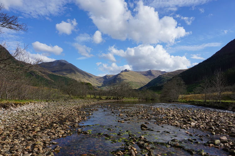
When I was looking at the map for somewhere to camp I spotted an island on the River Nevis, roughly an hours walk from the town. The romantic appeal got the better of me and I found a spot on the bank overlook the river.
The following day was the last, I made my way to the trainstation and boarded the train to Glasgow for my flight. The most notable thing was watching a couple with a pushchair and a 3yr old get out at Corrour station. It’s a lonely platform with a scattering of small buildings in a vast moorland. It’s known as the being the highest station in the UK and only accessible by train or a 20 mile walk. It was the oddest experience watching the small family get out and then turn to watch the train disappear, much like a western film when the train stops in the middle of a desert and a tumbleweed blows past.

My conclusion of the West Highland Way is that it is a great entry point to Scotland, giving glimpses of expanses of wilderness without leading you away from the safety of civilisation. The popularity of the route (and doing it over the bank holiday week) is a real downside, with plenty of people walking the same path. Other than when camped off route high up a valley, I estimated I was never more than half a mile from another person and probably less most of the time. I walked and chatted with a few people each day for about 20 minutes at a time, which made the day more interesting but doesn’t negate the annoyance of having loads of people around you in what is supposed to be remote.
Now I have walked the route, a future trip to Scotland would be focused on either a less popular long distance walking route, or starting from Kinlochlevan to do a dedicated Munro bagging expedition.

