
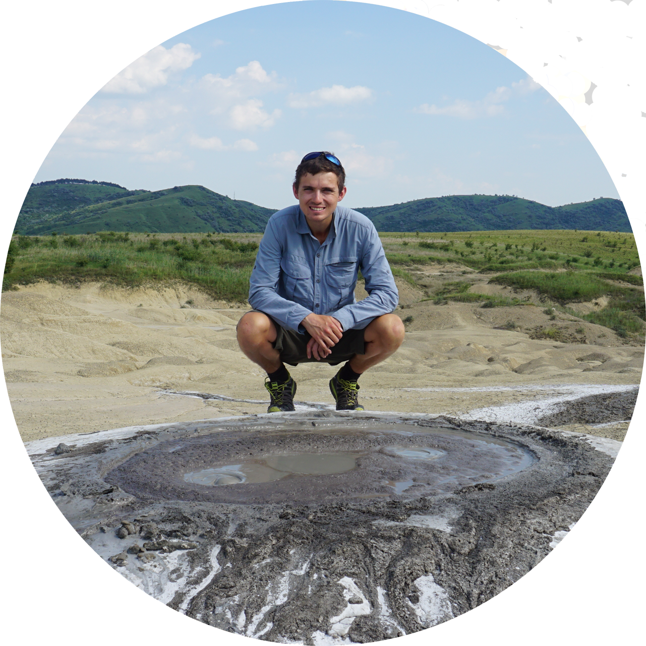
Walking in Portugal: GR34 Serra Amarela trail

This is the final section of the Portugal walk in 2021, which I’ve finally finished writing.
Our plan to set off from the semi-illegal campsite in the early hours didn’t come to fruition, mainly due to needing a longer rest and enjoying the quiet of the campsite. Despite this we were not discovered and set off at around 9am. We immediately ran into problems on the first part of the day, mainly because we decided not to follow the route. The GR50 goes through Gerês lower down from the campsite but we decided to follow a footpath up the valley side that was near to the campsite. Which is where we went wrong.
It can be summed up in one word: Mimosa. And not the tasty orange flavoured alcohol, I refer to the horrendously invasive tree that dominates many valleys in Portugal. It is perhaps their most invasive species, and even thinking it would look nice in the garden is illegal (buying, selling, cultivating, are all illegal). It was imported from Australia over 100 years ago due to the beautiful yellow flowers. However it thrived in Portuguese conditions and quickly became too well established to effectively remove.
Part of the reason is that the tree is superbly good at propagating. In summer it is covered in hundreds of tiny flowers that form trailing strings of bright yellow, these then form pods with around eight seeds in each which disperse over the area. If cut down before flowering but without removing the roots, then it just sprouts up all over the place from the existing root systems.

We followed the footpath just long enough to not want to turn around and then it got progressively worse. The mimosa closed in around us and the only way out was to continue up, the going slow, and the heat barely tolerable. The one advantage was that the mimosa was so thick that the temperature was a bit lower in the shade. What should have taken under two hours ended up taking more than three and left us exhausted.
We eventually emerged onto the hillside overlooking the valley and then had to struggle through viciously sharp brush and gorse to reach the GR34 again. However at the top of the route we found it opened up into a mountainous valley covered in heather and craggy granite outcrops.

At this point we had about 5 days of walking left before our flight back and so instead of following the GR50 ever onwards and potentially getting stranded we decided to do the GR34 – Serra Amarela trail. It’s a 22m/35km circular hike through the mountains that starts and ends at the reservoir, and so perfect for a final short walk.

From our lunch spot at Museu Etnográfico de Vilarinho das Furnas (which has picnic benches and an outside tap!) I spotted a flat looking area on the map at the reservoir and so we decided to walk a little bit further and try to camp there. It would have been possible to camp at the Museu, but not comfortable due to being more public and near a road.


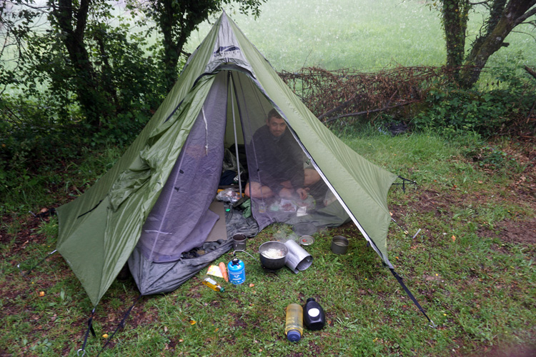
A storm started rolling in as we walked around the lake and we were desperately hoping that Vilarinho das Furna would be ok for camping as the GR34 then left the lake and went into the mountains were camping looked unlikely.
We walked in the rain for about 30 minutes and reached it just as the thunderstorm finished. Fortunately it looked perfect for camping, with lush grass and many flat spaces where the stones were piled into walls that used to be near an old village.


The history of Vilarinho das Furna is quite interesting. It is the remains of a village that was intentionally submerged by the Portuguese government in 1972. Now it is a ghostly ruin that emerges from the water during the hot summers and becomes a tourist attraction. It was too early in the year for us to see the houses but we did get to camp in the old field system. The walls created little pools of shallow water which were slightly warmer and well suited for a bath.

The bad weather continued over the next two days and most of our walk up to the high point of the GR34 was in cloud and unfortunately not particularly worth the effort. There were the occasional cabana which we ducked into for some shelter.


We walked to the radio towers at the top of Louriça (1359m) and had lunch against one of the walls in an effort to shelter form the bad weather. The mountain sides are littered with cabana but most are small stone domes and not worth sleeping in unless caught in absolutely horrendous weather.
We camped next to Cabana de Esacavilheira, which is another dome bothy but also has many rustic picnic tables and a spluttering water trough.

After Cabana de Escravilheira we crossed Rio da Frieira using a clapper bridge which conjured up memories of walking Ten Tors on Dartmoor in my younger days. A Clapper Bridge is a bridge made from slabs of granite resting on more granite or the banks of the stream. There were the remains of houses and an old mill with a millstone, but now with the roof fallen in and abandoned.


Branda de Bilhares is an abandoned ‘summer village’ and one of the highlights of both the GR34 and G50. It is an ancient village used in the summer for agriculture, so around the village is a network of lameiros (water-meadows) and the levadas that channel water around the fields. There are also occasional cork oak trees with the bark (or lack of) showing evidence it is still harvested.


The next stop on the route is Ermida, a small mountain town which is high up a twisty cobbled road and hard to get to. The road passes over Cascata da Ermida, a popular waterfall with tourists and a good swimming spot in warmer weather. It flows out of a small gorge above the road which is also fun to explore, and good for a lunch spot.


The bad weather descended again after Ermida and we pushed on in the pouring rain, struggling to find anywhere to camp after the small village of Germil. In Brufe we decided to follow the river down and found a small dam with an access track. We pitched up and hoped that no-one would turn up wanting to use it.
The weather lifted the next day and we decided to do the full GR36 loop, climbing into the mountains again and camping at 1100m near a tiny stream.


It was then a 4km drop back down the mountain side to the lake where we started four days ago and back to Gerês. We spent the final night in the mountains camping just above Gerês at a picnic spot below a huge granite outcrop called Curvaceira. It was on the road but had a water trough and wasn’t too busy, and had the advantage of being about 5km from Gerês, placing us in a good position to walk to the town the following day and catch the bus.

We followed the official GR50 route back to Gerês, and avoided the tortuous Mimosa woods. We caught the bus from Gerês back to Braga and then the train to Porto where we stayed a night in a hotel and explored the city for a day.


It is definitely worth visiting Peneda-Gerês to walk both the GR50 and GR34, and sooner rather than later. We saw the old way of life, with farmers in traditional clothes and working the land manually. However, the area is beginning to become more modernised, with tourism and increasingly commercialised villages and so some of the charm will slowly fade away, though the beautiful mountains, granite outcrops and occasional lush valleys will remain.

Downloadable route map here: Routes
1. Walking in Portugal: GR50 from Tourém to Xertelo
2. Walking in Portugal: PR9 Trilho das 7 Lagoas
3. Walking in Portugal: GR50 from Xertelo to Gerês
4. Walking in Portugal: GR34 Serra Amarela trail


Hello William,
I’m trying to identify the exact location of a shepherd’s hut (possibly Cabana do Fial) and the viewpoint from which Louriça was photographed. I noticed that your photos look very similar.
Would you mind having a look at two or three of my photographs to see whether you recognise the location?
Many thanks for your excellent blog!
Hello Jacques, yes happy to help. It was a few years ago now but I do have the locations we camped pinned so may be able to work it out. I am not sure the best way for you to share them though